
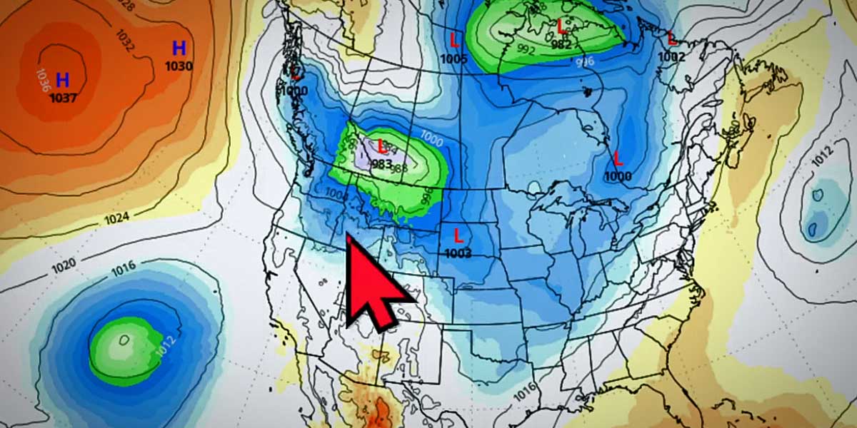
Winter isn’t over yet folks, as the National Weather Service is warning that the first of several weather systems will arrive on Sunday, Feb. 25, 2024, with heavy mountain snow, lowland rain, and windy conditions.
The active weather patterns will bring heavy mountain snow, gusty winds and a threat of lowland snow to the region over the short term.
But don’t worry too much, as forecasters say that “little or no snow accumulation (is) expected.”
The coldest period will likely be Monday night, when a low of 31 is forecast.
Forecasters are looking at total snowfall amounts between 1 to 3 feet for the Cascades, and a Winter Storm Warning remains in effect for the mountains.
Locally, expect south/southwest winds from 18 to 21 mph, with gusts as high as 32 mph, so be prepared for possible power outages as well.
Video Forecast
Here’s the latest forecast from local @SeattleWXGuy Michael Snyder:
Detailed 7- Day Forecast:
- Sunday: Rain. High near 49. South southwest wind 18 to 21 mph, with gusts as high as 32 mph. Chance of precipitation is 100%. New precipitation amounts between a tenth and quarter of an inch possible.
- Sunday Night: A chance of rain and snow before 11pm, then a slight chance of rain between 11pm and 2am, then a chance of rain and snow after 2am. Mostly cloudy, with a low around 36. Southwest wind 11 to 15 mph, with gusts as high as 20 mph. Chance of precipitation is 40%. Little or no snow accumulation expected.
- Monday: Rain and snow likely, mainly before 5pm. Mostly cloudy, with a high near 44. Southwest wind 7 to 14 mph becoming northwest in the afternoon. Chance of precipitation is 70%. Little or no snow accumulation expected.
- Monday Night: A chance of rain and snow before 11pm, then a slight chance of snow between 11pm and 5am. Mostly cloudy, with a low around 31. East northeast wind 5 to 7 mph becoming south southwest in the evening. Chance of precipitation is 40%. Little or no snow accumulation expected.
- Tuesday: A chance of snow after 11am, mixing with rain after 2pm. Partly sunny, with a high near 42. South southwest wind 7 to 10 mph. Chance of precipitation is 40%. Little or no snow accumulation expected.
- Tuesday Night: Rain. Low around 40. Chance of precipitation is 100%. New precipitation amounts between a quarter and half of an inch possible.
- Wednesday: Rain. High near 48. Breezy. Chance of precipitation is 100%.
- Wednesday Night: Rain. Cloudy, with a low around 38.
- Thursday: Rain. Cloudy, with a high near 44.
- Thursday Night: Rain before 11pm, then a chance of rain and snow. Mostly cloudy, with a low around 36.
- Friday: Rain and snow likely. Mostly cloudy, with a high near 46.
- Friday Night: A chance of rain and snow. Mostly cloudy, with a low around 34.
- Saturday: A chance of rain and snow. Partly sunny, with a high near 46.