UPDATE 2: This post has been updated with new information from Seattle City Light.
Strong winds from the “bomb cyclone” weather system caused widespread power outages across the area on Tuesday, Nov. 19, 2024.
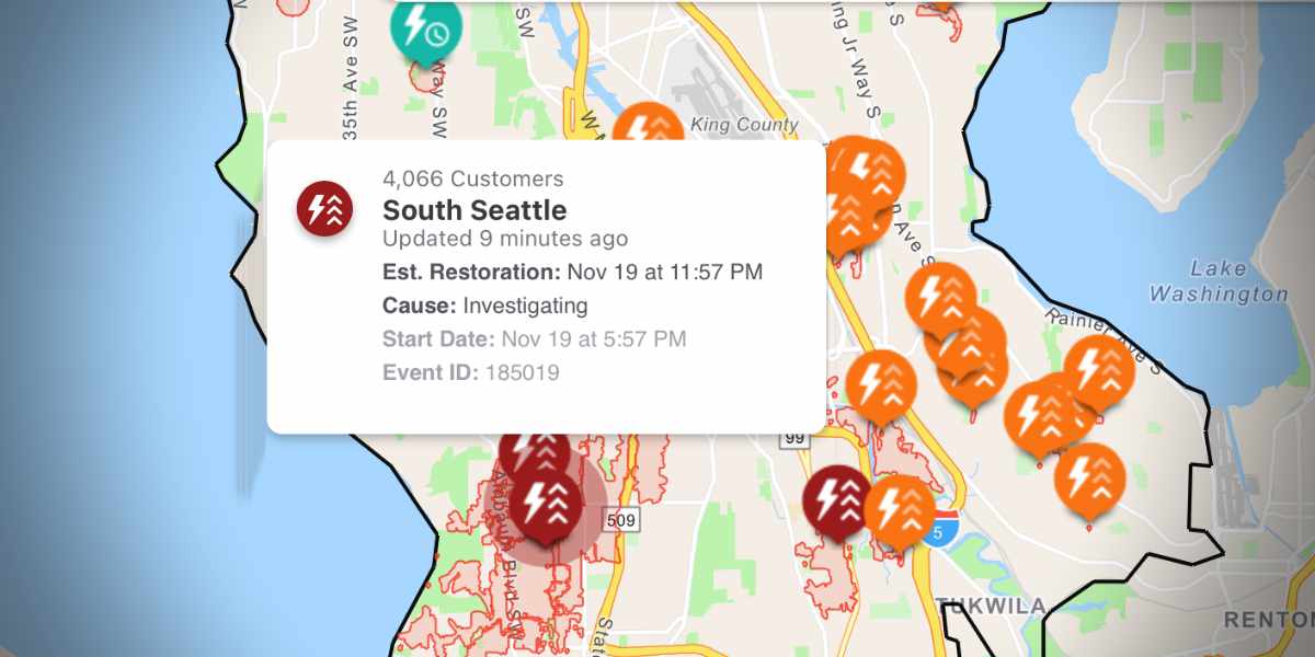
Over 20,000 Seattle City Light customers are without power, with the bulk of impacted customers in the Burien area. Outages are primarily impacting neighborhoods in the utility’s south service area, including Burien, White Center, and Tukwila.
Seattle City Light crews are working to restore power as quickly as possible.
Estimated restoration times vary, with most being predicted to not be completed until Wednesday morning or afternoon.
The utility has advised customers to monitor its online outage map for real-time updates on restoration efforts.
The storm’s high winds have downed tree limbs and power lines across the region, adding to the challenges faced by repair crews. Residents are encouraged to exercise caution around fallen power lines and to report any hazards to Seattle City Light.
The outages come as part of a broader pattern of severe weather affecting the Pacific Northwest, with meteorologists warning of continued gusty winds and potential additional outages throughout the night.
The strong winds have brought the number of customers out up to nearly 10,300, with the bulk of impacted customers, about 7,800, in the Burien area. Our crews will work as safely and efficiently as possible to restore power. Break out those flashlights!
— Seattle City Light (@SEACityLight) November 20, 2024
The National Weather Service extended its Wind Advisory through Wednesday morning. Nov. 20, 2024:
…WIND ADVISORY REMAINS IN EFFECT UNTIL 4 AM PST WEDNESDAY…
* WHAT…Southeast winds 20 to 30 mph with gusts up to 50 mph expected.
* WHERE…Portions of northwest and west central Washington.
* WHEN…Until 4 AM PST Wednesday.
* IMPACTS…Gusty winds could blow around unsecured objects. Tree limbs could be blown down and a few power outages may result.
* ADDITIONAL DETAILS…Strongest winds will occur Tuesday evening into early Wednesday morning. Significant impacts may occur at lower-than-usual wind speeds due to the atypical easterly wind direction.
PRECAUTIONARY/PREPAREDNESS ACTIONS…
Use extra caution when driving, especially if operating a high profile vehicles. Secure outdoor objects.
Secure outdoor objects.
A few things to keep in mind.
— NWS Seattle (@NWSSeattle) November 19, 2024
1) Winds will increase through the evening hours.
2) Strongest winds in this scenario are expected along the coast, near the Cascades, the N. Interior, and near the strait.
3) East/southeast winds can be highly localized and terrain driven.#wawx pic.twitter.com/i1yqhmN2Ld


