
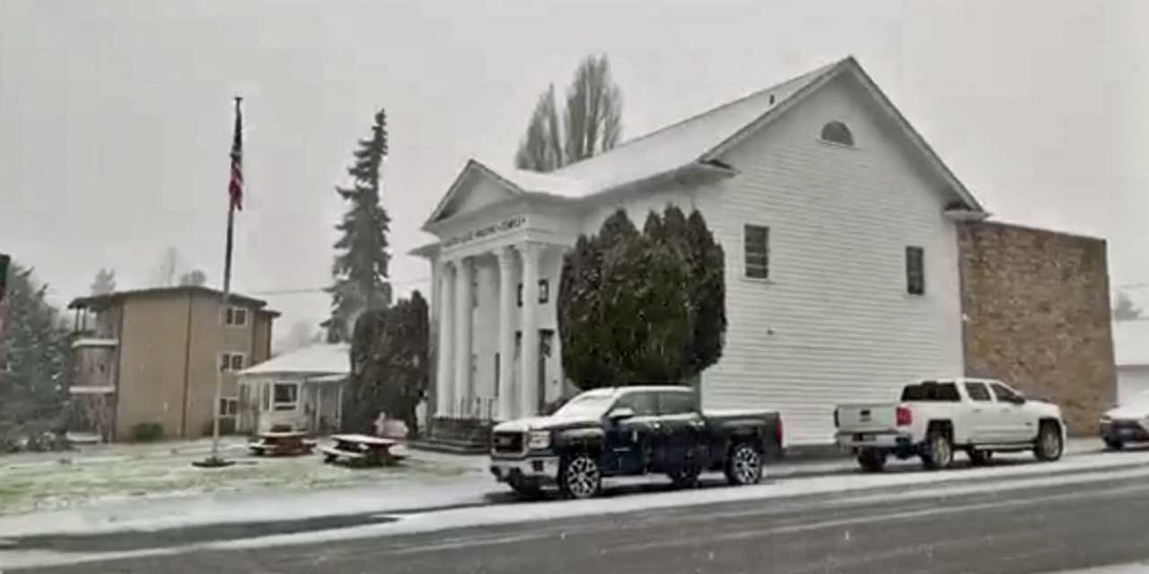
The snow has finally arrived in Burien, and as of 4 p.m. Monday, Jan. 13, 2020 it continues to fall – around Olde Burien at least – and is sticking to roads and lawns and roofs and cars and…
The National Weather Service also issued a ‘Winter Weather Advisory,’ warning that additional snow accumulations of up to one inch will coat B-Town up until around midnight tonight:
Winter Weather Advisory
URGENT – WINTER WEATHER MESSAGE
National Weather Service Seattle WA
340 PM PST Mon Jan 13 2020
WAZ507-555-556-558-140800-
/O.EXT.KSEW.WW.Y.0005.000000T0000Z-200114T0800Z/
Everett and Vicinity-East Puget Sound Lowlands-
Bellevue and Vicinity-Seattle and Vicinity-
including Everett, Lynnwood, Marysville, Stanwood, Bonney Lake,
Maple Valley, Monroe, Woodinville, Arlington, Granite Falls,
Lake Stevens, Snohomish, Gold Bar, Duvall, Carnation, Fall City,
Snoqualmie, North Bend, Covington, Black Diamond, Orting,
Eatonville, Bellevue, Bothell, Kenmore, Mill Creek, Clearview,
Kirkland, Newcastle, Redmond, Sammamish, Issaquah, Seattle,
White Center, Tukwila, Renton, Burien, Des Moines, Kent,
and Federal Way
340 PM PST Mon Jan 13 2020
…WINTER WEATHER ADVISORY NOW IN EFFECT UNTIL MIDNIGHT PST
TONIGHT…
* WHAT…Snow showers. Additional snow accumulations of up to one
inch.
* WHERE…Bellevue and vicinity, including Mill Creek, Kenmore,
Kirkland, and Issaquah, East Puget Sound Lowlands from
Snohomish County to Pierce County, including Arlington, Gold
Bar, Duvall, Snoqualmie, Buckley, and Eatonville, Everett and
vicinity, including Stanwood, Marysville, and Mountlake
Terrace and Seattle and vicinity, including Shoreline, Vashon
Island, Mercer Island, White Center, Kent, and Algona.
* WHEN…Until midnight PST tonight.
* IMPACTS…Plan on slippery road conditions.
PRECAUTIONARY/PREPAREDNESS ACTIONS…
Slow down and use caution while traveling.
For the latest road conditions in Washington state, call 5 1 1.
Here’s the latest 7-day forecast:
-
- Tonight: Snow likely. Mostly cloudy, with a low around 26. Wind chill values between 18 and 23. North wind around 9 mph. Chance of precipitation is 60%. New snow accumulation of less than a half inch possible.
- Tuesday: A 50 percent chance of snow. Mostly cloudy, then gradually becoming sunny, with a high near 31. Wind chill values between 18 and 26. North northeast wind around 6 mph. New snow accumulation of less than a half inch possible.
- Tuesday Night: A 30 percent chance of snow. Mostly cloudy, with a low around 26. Wind chill values between 19 and 24. East wind 5 to 9 mph. New snow accumulation of less than a half inch possible.
- Wednesday: A 40 percent chance of snow. Mostly cloudy, with a high near 33. East wind 13 to 17 mph, with gusts as high as 21 mph. New snow accumulation of less than a half inch possible.
- Wednesday Night: Snow likely. Cloudy, with a low around 31. Breezy. Chance of precipitation is 60%. New snow accumulation of less than a half inch possible.
- Thursday: A 50 percent chance of snow. Mostly cloudy, with a high near 33. New snow accumulation of less than a half inch possible.
- Thursday Night: A chance of snow. Mostly cloudy, with a low around 28.
- Friday: Snow likely before 1pm, then rain and snow likely. Cloudy, with a high near 38.
- Friday Night: Rain and snow likely before 10pm, then rain. Cloudy, with a low around 35.
- Saturday: Rain. Cloudy, with a high near 43.
- Saturday Night: Rain likely. Cloudy, with a low around 39.
- Sunday: A chance of rain. Mostly cloudy, with a high near 45.
- Sunday Night: A chance of rain. Mostly cloudy, with a low around 38.
- M.L.King Day: A chance of rain. Mostly cloudy, with a high near 46.
VIDEO
Also, Scott Schaefer walked around Olde Burien in his tennis shoes and streamed this video live (without slipping once!) on our Facebook page: