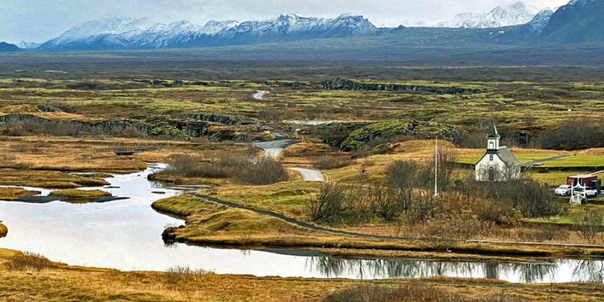
The little church is built where the first church was built over 1,000 years ago, This is in the valley made by the rift separating the two tectonic plates. The low dark ridge in the background is the eastern rampart of the ridge and shows where the western edge of the European plate ends. The photo was taken from the rampart on the eastern edge of the North American plate ends
EDITOR’S NOTE: Burien resident Fred Feiertag’s column for The B-Town Blog will help you start your week every Monday. He will be sharing his observations, travel stories, wanderings and more…
Story & Photos by Fred Feiertag
After the tasty snack of Icelandic rye bread steamed in the geothermal sand we were off to see if Iceland is all it is cracked up to be.
We left Þingvallavatn behind and traveled through more barren seemingly barren hills. The distant glaciers rimmed the eastern horizon emphasizing that this is a different world. We soon arrived at a place to further confirm that conclusion.
Thingvellir National Park is interesting in so many ways. It is of geographic, historic, social, and scenic interest. I’ll tackle these in order, starting with geography. It turns out that Iceland sits on the border between tectonic plates. We know of tectonic plates as the engine that drives our big Cascade volcanoes. The North American plate is moving west over the tiny San Juan Plate causing huge friction that sends hot plumes of magma upward to spawn and feed the volcanos. Mt. St.Helens reminds us that this isn’t just some scientific theory. Iceland holds the precarious spot on the border of the European plate and the North American plate. These two are moving apart a couple inches per year and this drives many Icelandic volcanoes. From the visitor center in the national park the view point seems like a pleasant vista until interpreted. To the east is a low rampart stretching from left to right about a mile or so distant. The viewpoint is also on a similar rampart. Between is green flat valley with a small river leading to Þingvallavatn Lake. It became amazing to understand that the two ramparts are on the two slowly separating tectonic plates. We stood on the piece of the earth’s crust that includes the USA, Canada, Greenland, and more. The other side of the valley is the plate that contains Europe and so much more. My mind was officially boggled.
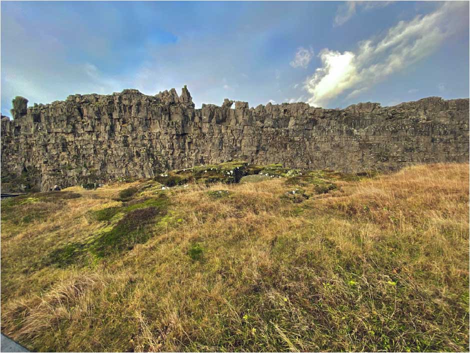
Then history was shown to be equally fascinating. On a small side hill to the western rampart is where the Alþingi, a Viking word now in Icelandic, that means pace where that first assembly met in 930 CE, 1,092 years ago. Leaders of all Viking tribes met to decide on a single chieftain and the laws for the next 3 years. The details are fascinating to history students and worth some homework if you are so inclined. The Alþingi is recognized as the first parliament in the world and though it has evolved to meet modern society Iceland still has a parliament that meets in the Alþingishúsið, Parliament House, in Reykjavik.

The society part is a darker chapter told by the Thingvellir National Park. From the visitor center is a path that follows one of the many fissures in the valley from the spreading tectonic plates. Along the way we learned that in 1241 Norway took over Iceland and imposed very strict laws including the death penalty. For 180 years executions were performed in what is now this national park. Along the path is a very pretty bridge over a rushing stream with a small waterfall.Just upstream from the bridge is a pool called Drekkingarhylur in the stream where 18 women were drowned for infidelity or incest. Nearby are separate spots for hangings, beheadings, and of course a place for burning accused witches at the stake. I found the signage at the drowning pool interesting in that each of the executed women’s names were printed. Nothing in the text offered or attempted to justify this barbaric period. Iceland, fortunately, has no history of genocide to ignore or explain away.

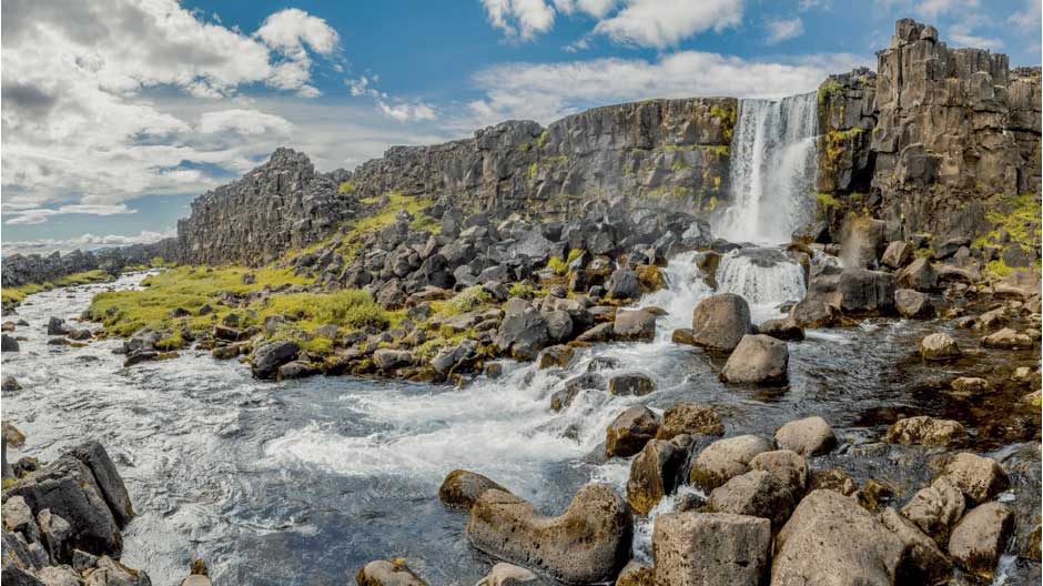
Last but not the least is the scenery. The realization that the view includes the actually wound where the entire Island being pulled apart makes the place more than a bit eerie. The broader view adds to this with the rough stone platform of the first Alþingi just below the lava stone rampart of the western rift boundary. Then the pretty Öxarárfoss waterfall used as scenery in the Game of Thrones TV series. Mentioned above is the Drekkingarhylur pool where the women were drowned. Beyond is the beautiful Þingvallavatn lake with the distant plumes of steam rising. The entire picture is a stew of fascination for me.
Leaving Thingvellir National Park came too soon for me. I wanted to spend much more time walking the trails, reading the signs, and taking many more pictures. I will return for those reasons and more. My desire to study the facts of the history presented here seem to have taken hold. But today’s exploration had much more to see and do.