
A powerful storm system fueled by an atmospheric river stretching from the Pacific Ocean is set to bring heavy rain, flooding, and strong winds to the Pacific Northwest in the coming days, according to local meteorologist Michael Snyder of Pacific Northwest Weather Watch.
“This is the storm train we’ve been talking about, and it’s now at our doorstep,” Snyder said in his latest forecast (see video below). “We have windstorm potential, very heavy rainfall, and flooding concerns across multiple areas.”
Flood Watch Issued
The National Weather Service also issued a Flood Watch in effect for the region from Sunday morning through late Tuesday night, as an atmospheric river brings heavy rainfall and rising snow levels. Forecasters warn that 3 to 5 inches of rain, with locally higher amounts, could trigger flooding in rivers, creeks, urban areas, and low-lying locations, while landslide risks will also increase. Snow levels are expected to rise above 7,000 feet, worsening runoff and potential river flooding. Residents in flood-prone areas are advised to stay informed and be prepared for potential Flood Warnings in the coming days.
“Avalanche warnings are also in place,” Snyder said. “The combination of heavy wet snow and rainfall over an existing snowpack is creating dangerous conditions.”
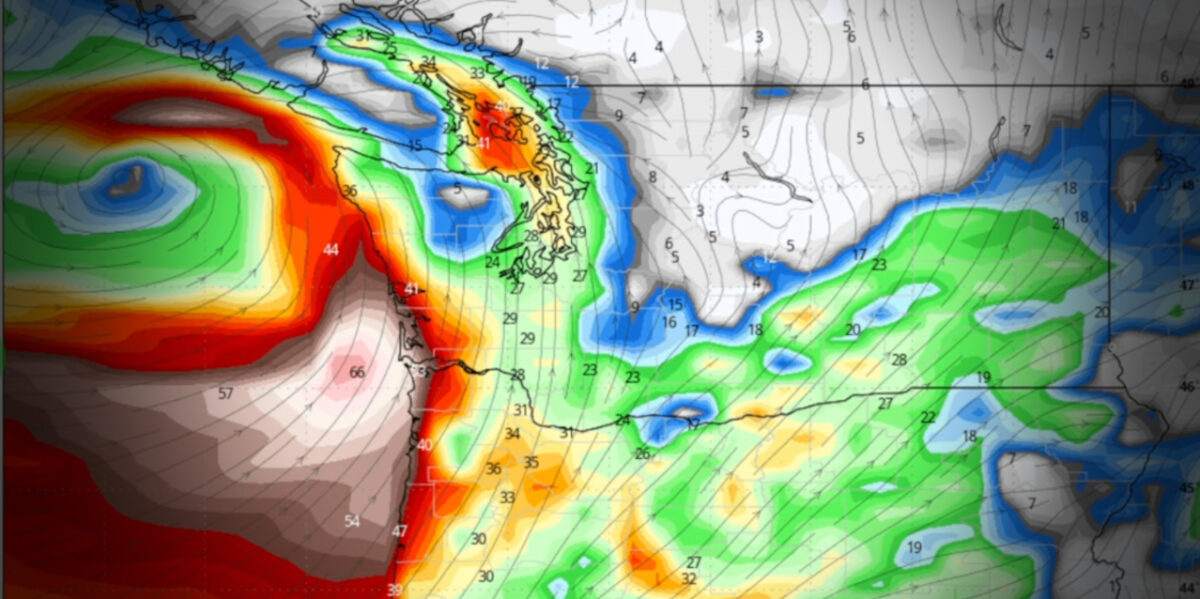
Windstorm Potential: Coastal Areas on Alert
A strong storm is expected to reach the Washington and Oregon coastlines on Monday, Feb. 24, bringing hurricane-force wind gusts of up to 70 knots (80 mph) offshore. While high winds will batter the coastline, uncertainty remains about the extent of inland wind impacts in areas like Seattle and Portland.
“This is not a historic 30-year windstorm, but it could still be a significant event,” Snyder said. “I’m skeptical of extreme wind gusts in the Seattle metro, but coastal areas and higher elevations could see damaging conditions.”
What to Expect
- Heavy Rainfall: Flooding likely in lowland areas, river basins, and urban streets.
- Snowmelt and Runoff: Increased risk of landslides and rapid river rises.
- Strong Winds: Coastal gusts up to 80 mph; interior wind potential remains uncertain.
- Avalanche Risk: Warnings in effect for backcountry travelers.
Snyder urged residents to stay informed and take precautions, including avoiding flooded roads. “Turn around, don’t drown,” he reminded viewers.
More updates are expected as meteorologists track the storm’s final trajectory.
Video
Here’s Snyder’s latest video forecast, released Saturday morning, Feb. 22, 2025:

Detailed 7-Day Forecast
- Saturday: Rain, mainly after 1pm. High near 54. South wind 11 to 15 mph, with gusts as high as 26 mph. Chance of precipitation is 100%. New precipitation amounts between a quarter and half of an inch possible.
- Saturday Night: Rain. Low around 50. South wind 11 to 14 mph, with gusts as high as 23 mph. Chance of precipitation is 100%. New precipitation amounts between three quarters and one inch possible.
- Sunday: Rain. High near 55. South southwest wind 9 to 11 mph, with gusts as high as 21 mph. Chance of precipitation is 100%. New precipitation amounts between a half and three quarters of an inch possible.
- Sunday Night: Rain, mainly before 10pm. Low around 45. South southwest wind 10 to 13 mph, with gusts as high as 23 mph. Chance of precipitation is 100%. New precipitation amounts between a tenth and quarter of an inch possible.
- Monday: Rain, mainly after 10am. High near 52. East southeast wind 6 to 8 mph. Chance of precipitation is 90%. New precipitation amounts between a quarter and half of an inch possible.
- Monday Night: Rain. Low around 45. Chance of precipitation is 100%. New precipitation amounts between a quarter and half of an inch possible.
- Tuesday: Rain, mainly before 4pm. High near 51. Chance of precipitation is 90%.
- Tuesday Night: A chance of rain before 10pm. Mostly cloudy, with a low around 41.
- Wednesday: Partly sunny, with a high near 58.
- Wednesday Night: Mostly cloudy, with a low around 43.
- Thursday: A chance of rain. Partly sunny, with a high near 57.
- Thursday Night: A slight chance of rain. Mostly cloudy, with a low around 42.
- Friday: A slight chance of rain. Partly sunny, with a high near 57.